Log in
All resources
Create a design
938 Free Artworks of Maps Of Italy
bologna ptolemy
latin-language maps
1477 maps
bibliothèque nationale de france
atlas maior, vol 9 (italy) - joan blaeu, 1667 - bl 114.h(star).9
1667 maps of italy
copper engraving print
british library
joan blaeu
maps in portrait paintings
media from accademia delle scienze di torino
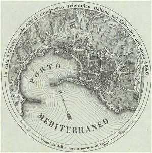
harbour of genoa
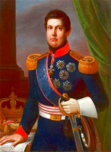
portrait paintings of ferdinand ii of the two sicilies
giuseppe bonolis
book collection of the chester beatty library
l'isole più famose del mondo
pages with maps
base mérimée
house of bourbon-two sicilies
1830s military uniforms
1750s paintings from italy
ferdinand
maps by john cary
county of tyrol
portrait paintings of leopold ii, grand duke of tuscany
pietro benvenuti
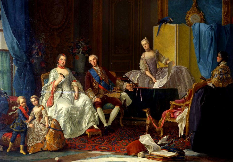
victor amadeus iii of sardinia
ermine (clothing) in art
portrait paintings by michele gordigiani
scapigliatura
caricatures of napoleon i of france
napoleon on elba
baroque
fizzo
cornelis danckerts (ii)
1640 maps of italy
maps by john cary
1799 maps
old maps of the republic of genoa
maps of the duchy of milan
1370s maps of egypt
catalan atlas
17th-century paintings of soldiers
lambert de hondt (ii)
italia antiqua (galleria delle carte geografiche)
old maps of italy
old maps of marche
1624 maps of italy
old maps of the province of bergamo
1580 maps
latin-language maps
bologna ptolemy
16th-century maps of the adriatic sea
willem barentsz
maps by willem and johannes blaeu
old maps of the republic of genoa
medieval history of near east
geography of near east
maps from gallica
old maps of genoa
map of italy by guillaume delisle (1700)
1700s maps of italy
map of italy by guillaume delisle (1700)
eran laor cartographic collection
latin-language maps
bologna ptolemy
18th-century maps of veneto
1700s maps of slovenia
old maps of the carolingian empire
atlas van loon
maps of ancient italy by philipp clüver
maps of ancient sicily
italia - di matteo greuter... - btv1b525056959
old maps of apulia
18th-century maps of veneto
1700s maps of slovenia
baroque frescos in catania
1669 maps
ptolemy's 10th european map
bologna ptolemy
ptolemy's 4th asian map
1470s maps of palestine
1799 maps of italy
maps by john cary
maps made in the 17th century
old maps of sicily
illuminated manuscripts in the museo correr
pietro vesconte
the hand-book for travellers in italy, from london to naples (1838)
old maps of tuscany
maps by john cary
county of tyrol
1470s maps of the world
latin-language maps
1470s maps of africa
1477 maps
ptolemy's 4th african map
1477 maps
ptolemy's 3rd african map
1477 maps
old maps of piedmont
maps by gerard valck
daniel de la feuille
1706 maps of italy
latin-language maps
bologna ptolemy
ptolemy's 9th asian map
bologna ptolemy
1780s maps of italy
maps by juan lopez
maps by pieter van der keere
maps by abraham ortelius
ptolemy's 1st asian map
bologna ptolemy
maps in the amsterdam museum
covens en mortier
bologna ptolemy
1477 maps
old maps of the republic of genoa
maps by alexis-hubert jaillot
latin-language maps
bologna ptolemy
ptolemy's 3rd european map
bologna ptolemy
ptolemy's 7th asian map
bologna ptolemy
ptolemy's 2nd asian map
bologna ptolemy
atlas maior, vol 9 (italy) - joan blaeu, 1667 - bl 114.h(star).9
1667 maps of italy
atlas maior, vol 9 (italy) - joan blaeu, 1667 - bl 114.h(star).9
1667 maps of italy
atlas maior, vol 9 (italy) - joan blaeu, 1667 - bl 114.h(star).9
1667 maps of italy
perusinus ac tifernas (galleria delle carte geografiche)
battle of lake trasimene
ptolemy's 7th european map
bologna ptolemy
latin-language maps
bologna ptolemy
ptolemy's 8th european map
bologna ptolemy
classicism
1482 maps
copper engravings in the universitätsbibliothek salzburg
wolf-dietrich-klebeband städtebilder
16th-century maps of rome
high renaissance
ptolemy's 6th european map
maps by girolamo porro
latin-language maps
bologna ptolemy
historisk atlas (stockholm, norstedt & söner, 1880)
maps of 11th-century italy
prato in the 20th century
maps of prato
maps by girolamo porro
liburnia
latin-language maps
bologna ptolemy
latin-language maps
bologna ptolemy
latin-language maps
bologna ptolemy
ptolemy's 1st european map
bologna ptolemy
media from accademia delle scienze di torino
1577 engravings
media from accademia delle scienze di torino
1577 engravings
media from accademia delle scienze di torino
1577 engravings
italia - di matteo greuter... - btv1b525056959
old maps of veneto
atlas maior, vol 9 (italy) - joan blaeu, 1667 - bl 114.h(star).9
1667 maps of italy
atlas maior, vol 9 (italy) - joan blaeu, 1667 - bl 114.h(star).9
1667 maps of italy
atlas maior, vol 9 (italy) - joan blaeu, 1667 - bl 114.h(star).9
1667 maps of italy
atlas maior, vol 9 (italy) - joan blaeu, 1667 - bl 114.h(star).9
1667 maps of italy
gaspard de chabrol
maps from gallica
bologna ptolemy
1477 maps
maps of ancient italy by philipp clüver
maps of ancient latium
maps from gallica
guides joanne
old maps of lazio
henry le roy
italia - di matteo greuter... - btv1b525056959
17th-century maps of istria
atlas maior, vol 9 (italy) - joan blaeu, 1667 - bl 114.h(star).9
1667 maps of italy
atlas maior, vol 9 (italy) - joan blaeu, 1667 - bl 114.h(star).9
1667 maps of italy
atlas maior, vol 9 (italy) - joan blaeu, 1667 - bl 114.h(star).9
1667 maps of italy
latin-language maps
bologna ptolemy
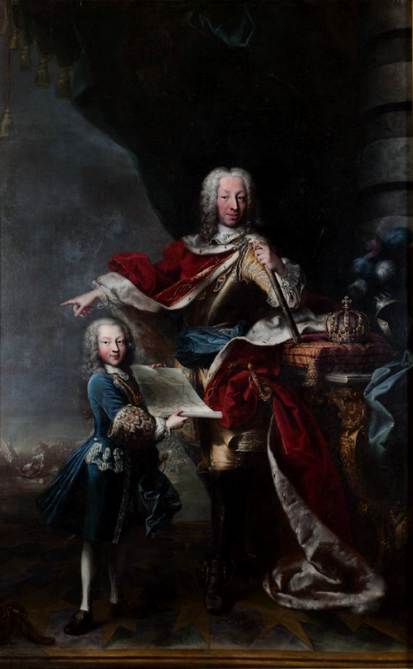
portrait paintings by giuseppe duprà (house of savoy)
portrait paintings of marie josephine louise of savoy
map of italy by guillaume delisle (1700)
bibliothèque nationale de france
maps of italy by sanson and cordier
bibliothèque nationale de france
18th-century maps of veneto
1700s maps of slovenia
101 - 200 of 938
Next page
/ 10


![Untitled [Map 7], 1477](https://cdn.creazilla.com/illustrations/10001152007/untitled-map-7-1477-md.jpg)


![Siciliae antiquae descriptio. 15; Corsicae antiquae descriptio. 16; Sardiniae antiquae descriptio / auctore Phil[ippo] Cluverio; Henry le Roy fecit, 1624](https://cdn.creazilla.com/illustrations/10001349357/siciliae-antiquae-descriptio-15-corsicae-antiquae-descriptio-16-sardiniae-antiquae-descriptio-auctore-phil-ippo-cluverio-henry-le-roy-fecit-1624-sm.jpg)


![Map 17 [Tabula 17], 1477](https://cdn.creazilla.com/illustrations/10001044525/map-17-tabula-17-1477-md.jpg)

![Map 12 [Tabula 12], 1477](https://cdn.creazilla.com/illustrations/10000439389/map-12-tabula-12-1477-md.jpg)

![Fifth [Map], 1477](https://cdn.creazilla.com/illustrations/10001286025/fifth-map-1477-md.jpg)


![Map 24 [Tabula 24], 1477](https://cdn.creazilla.com/illustrations/10001215414/map-24-tabula-24-1477-md.jpg)


![Sabinorum et Marsorum agri descriptio. 11; Typus utriusque Latii [...]. 8 / auctore Philippo Cluverio; H. Le Roy fecit, 1624](https://cdn.creazilla.com/illustrations/10001535937/sabinorum-et-marsorum-agri-descriptio-11-typus-utriusque-latii-8-auctore-philippo-cluverio-h-le-roy-fecit-1624-sm.webp)


![Map 22 [Tabula 22], 1477](https://cdn.creazilla.com/illustrations/10001610882/map-22-tabula-22-1477-md.jpg)


